Log in
All resources
Create a design
33,222 Free Images of Elevation Map
david rumsey historical map collection
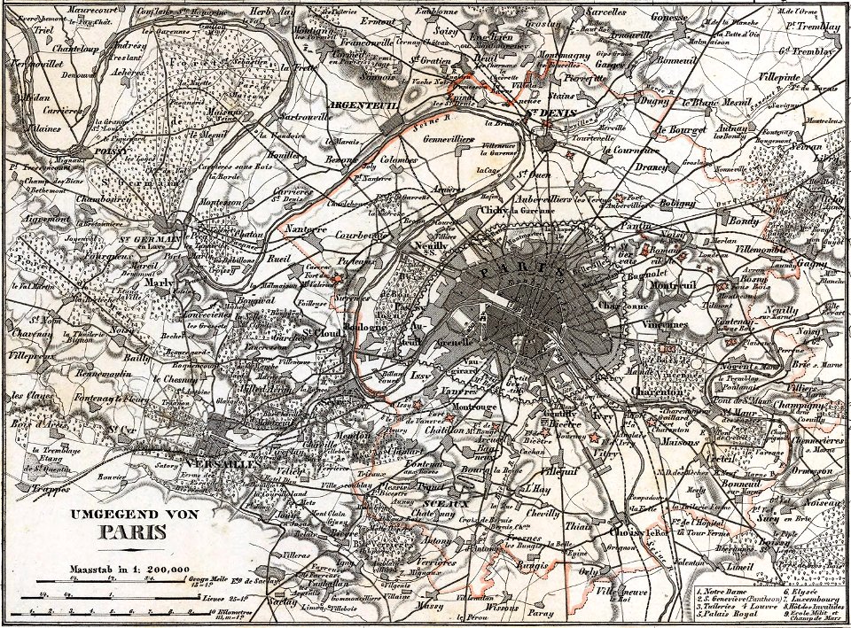
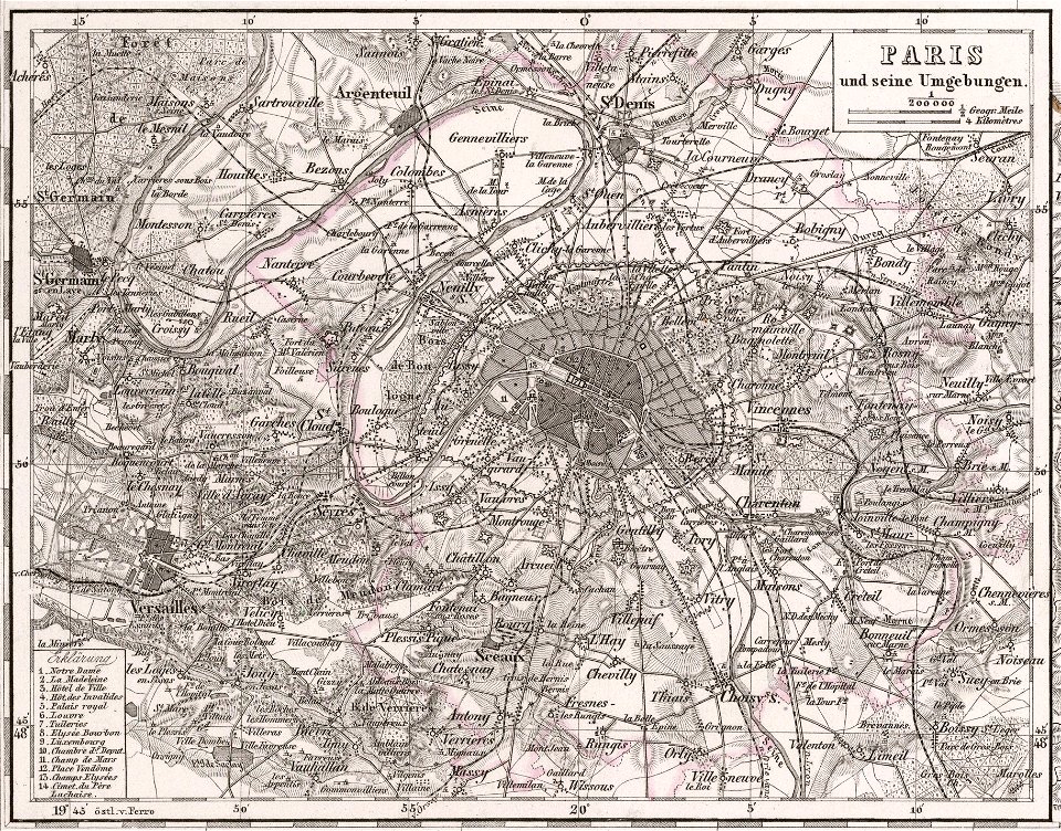
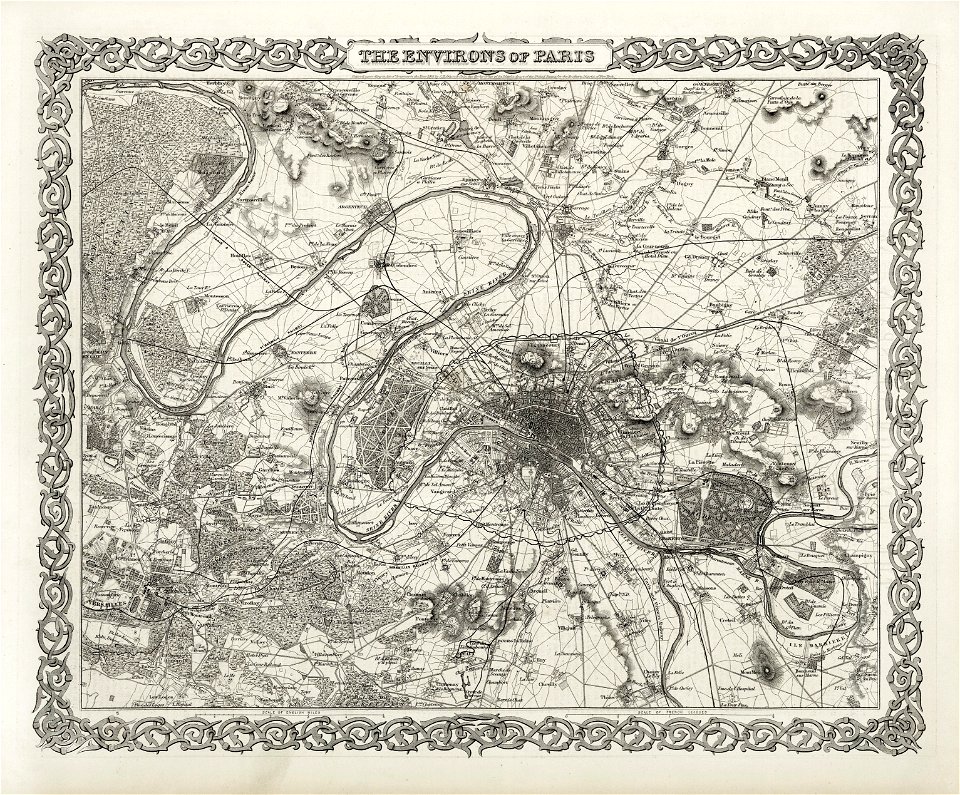
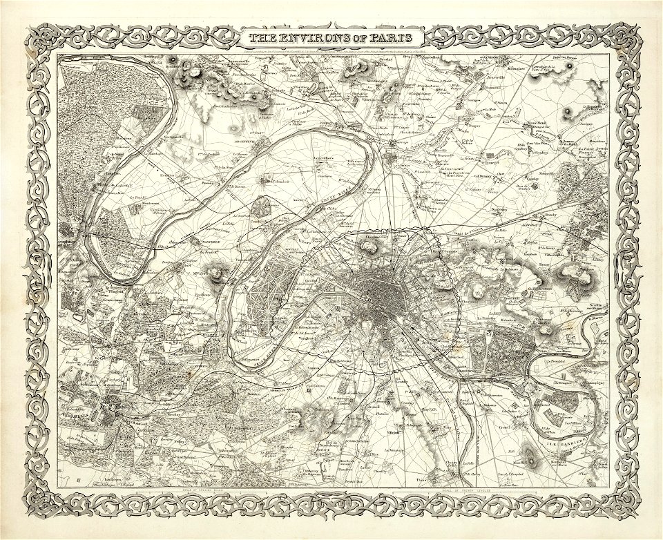
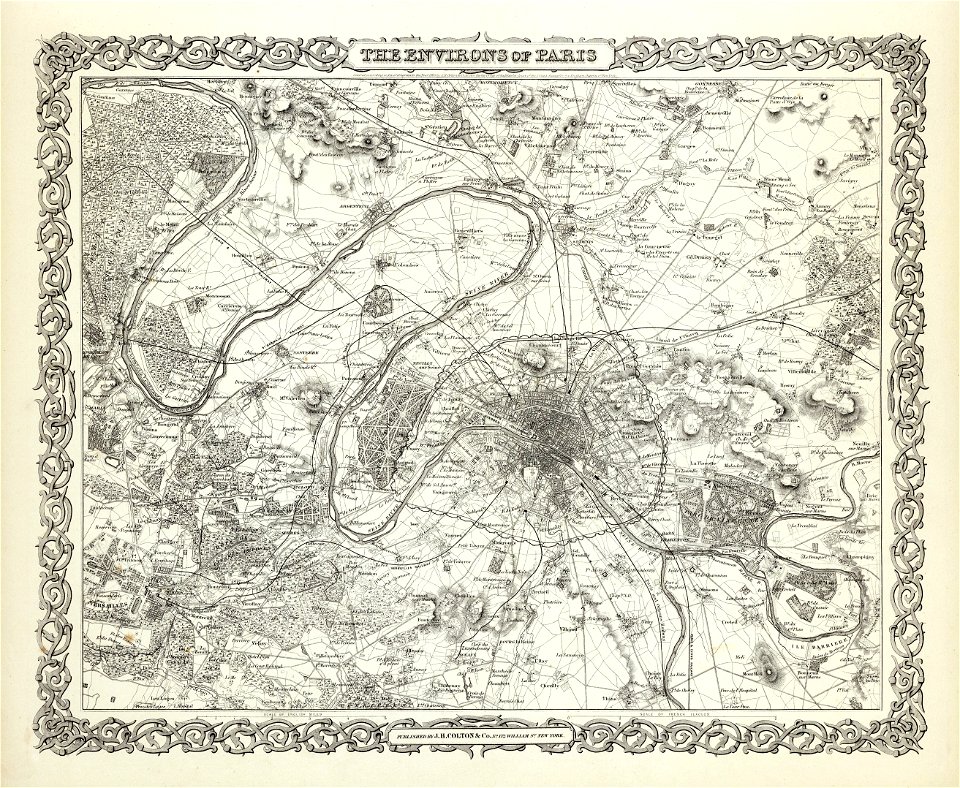
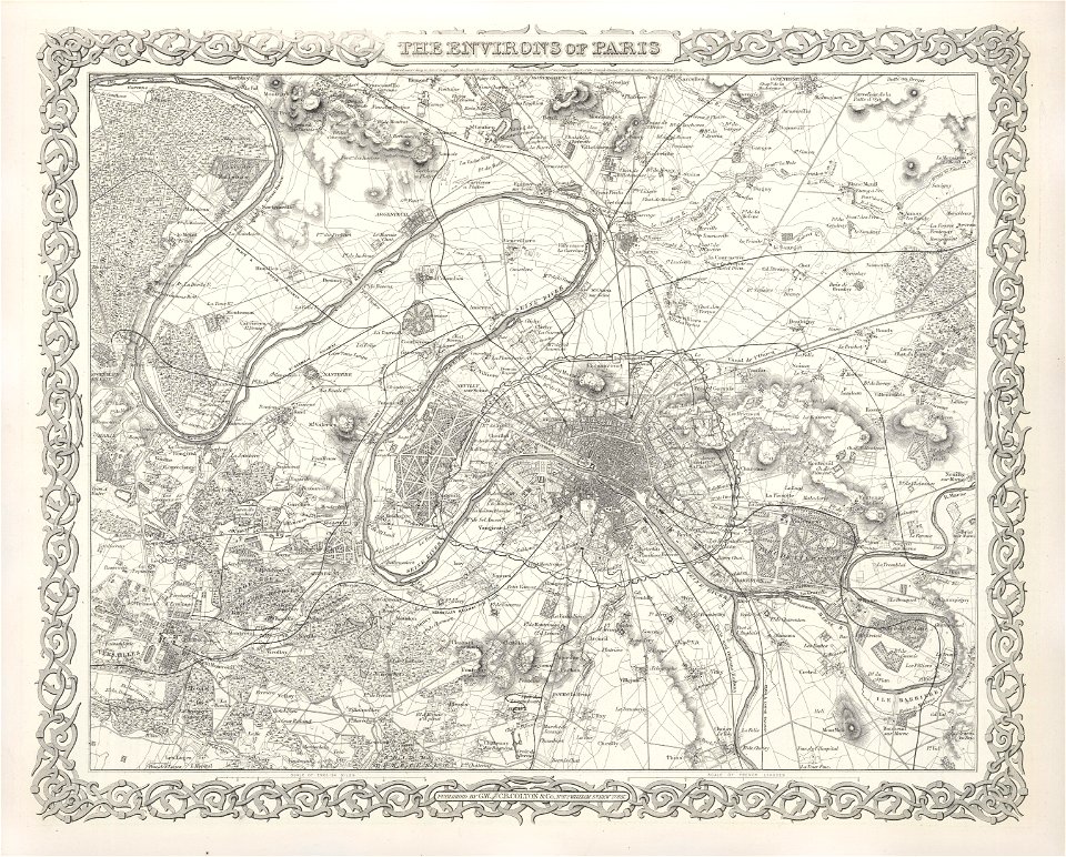
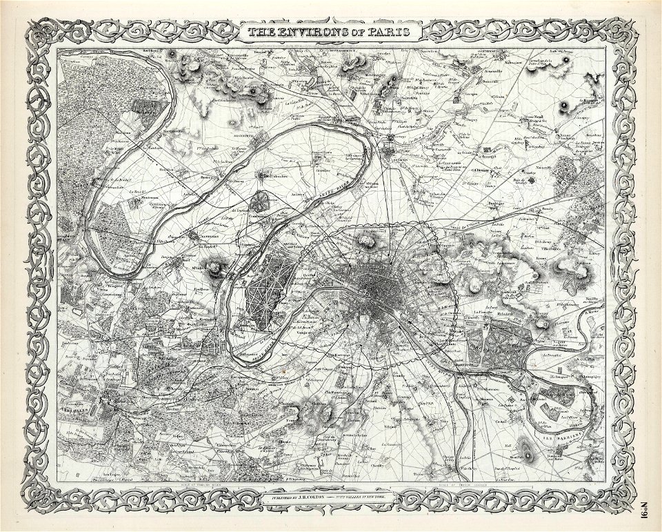
maps of paris from the david rumsey historical map collection
maps in the library of congress
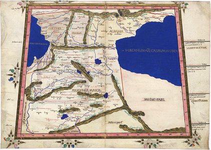
latin-language maps
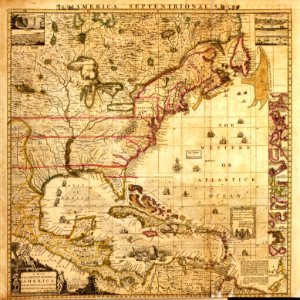
a map of the british empire in america with the french and spanish settlements adjacent thereto
old maps of the white sea
maps of the barents sea
dutch-language maps
baptista van doetecum
northern sea route
heinrich petri (printer)
maps with cartouches
1712 maps of puerto rico
johannes van keulen
david rumsey historical map collection
german-language maps
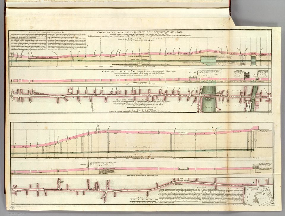
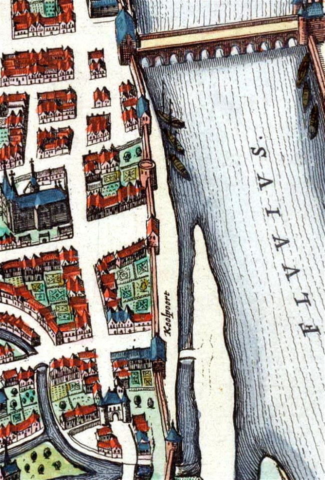
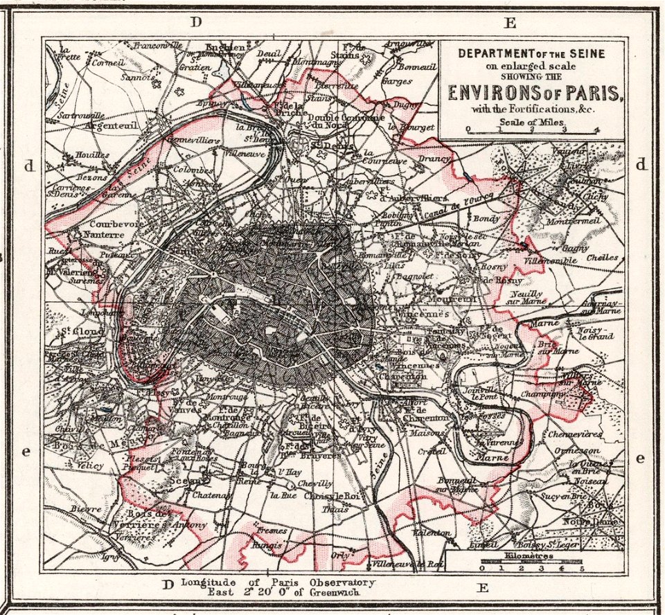
seine river in paris
old submaps of paris
sofala province
kilwa kisiwani
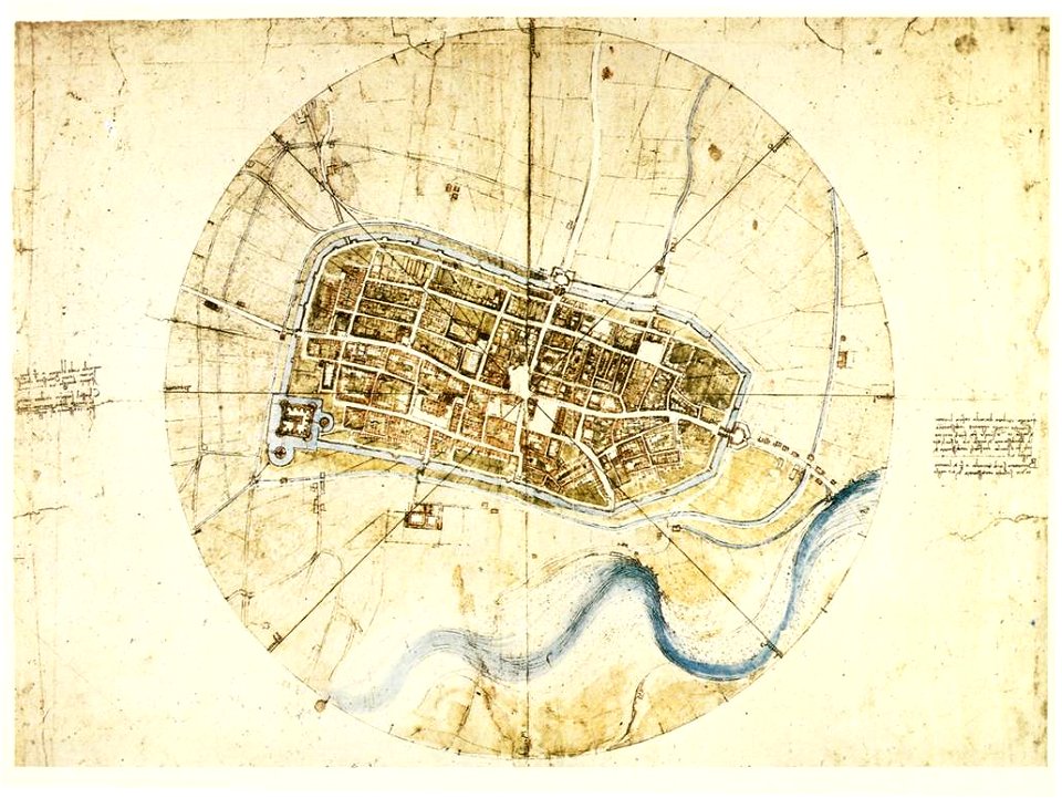
science and inventions of leonardo da vinci
pencil drawing
map of ferrara by andrea bolzoni
corso ercole i d'este (ferrara)
map of ferrara by andrea bolzoni
corso porta po (ferrara)
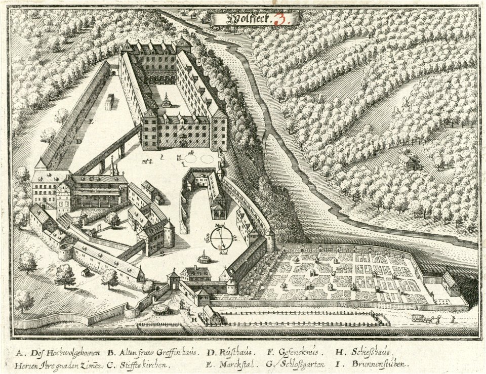
history of schloss wolfegg
1643 engravings
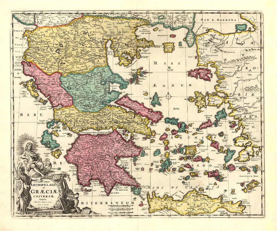
old maps of the aegean sea
old maps of greece
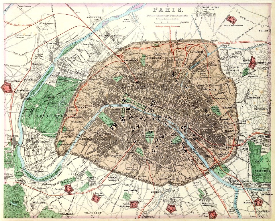
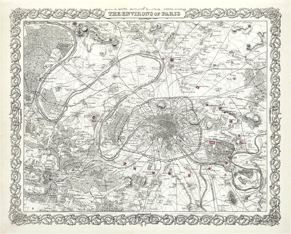
1862 in paris
1862 maps
david rumsey historical map collection
jr
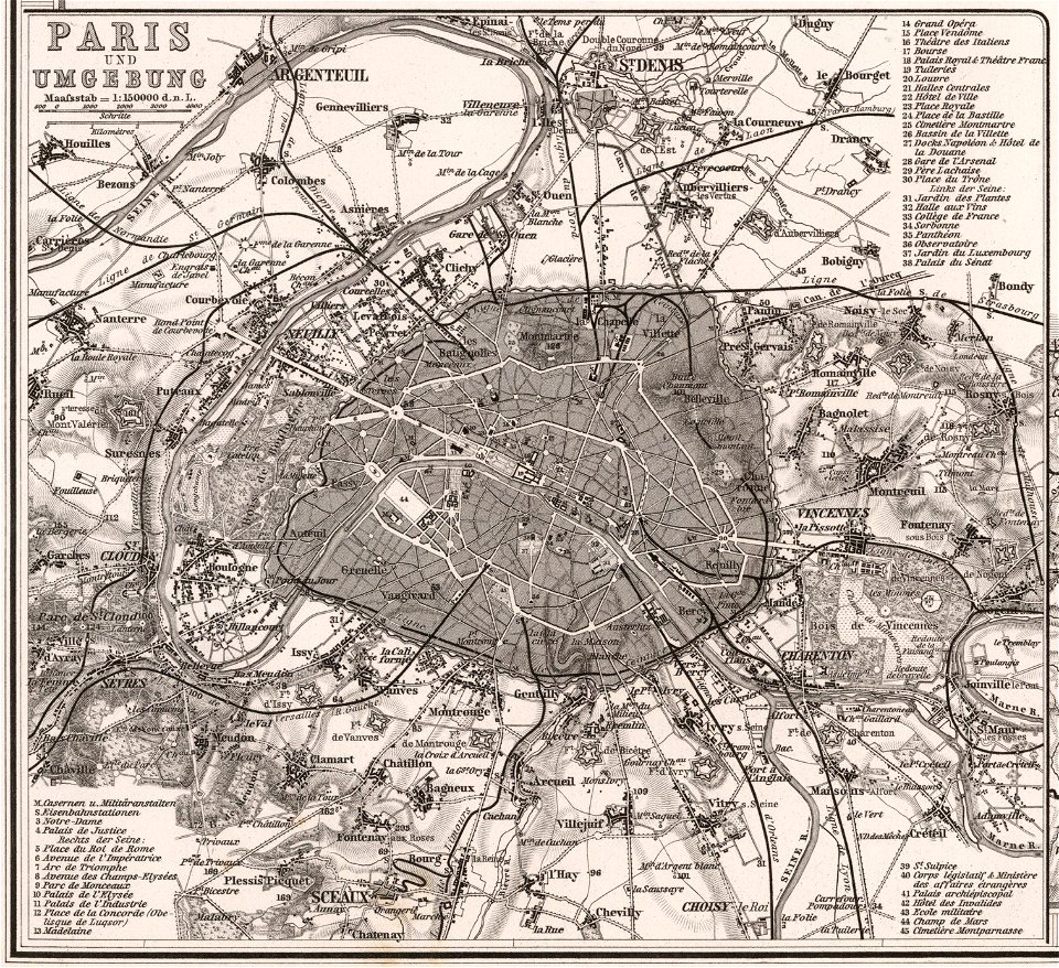
maps of paris from the david rumsey historical map collection
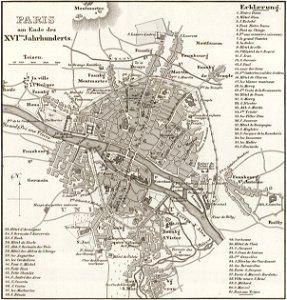
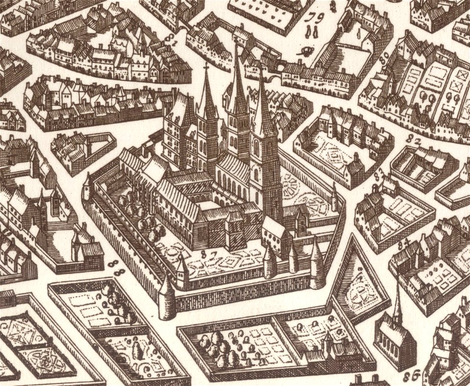
paris in the 16th century
1900s maps of paris
1900 in paris
maps of paris from the david rumsey historical map collection
1866 in paris
maps of paris from the david rumsey historical map collection
1873 in paris
david rumsey historical map collection
j. and p. knapton
new york
1891 map
maps of the elbe
alster (river)
third voyage of willem barentsz
16th-century maps of the arctic
third voyage of willem barentsz
16th-century maps of the arctic
third voyage of willem barentsz
16th-century maps of the arctic
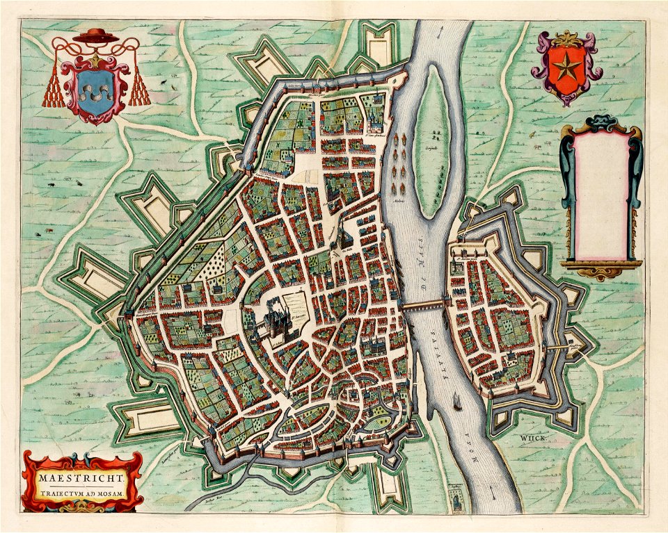
coats of arms of maastricht
coats of arms on maps
overwintering on nova zembla by willem barentsz, 1596-1597
maps in the rijksmuseum amsterdam
maps by george h. walker and company
maps in the library of congress
maps made in the 17th century
maps by nicolaes visscher i
old maps of the ottoman empire
old maps of poland
grote kerk
haarlem
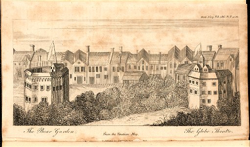
globe theatre
southwark
first medieval city wall of maastricht
history of vrijthof (maastricht)
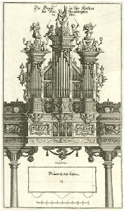
pipe organs in art
history of ulm
pipe organs in art
history of ulm
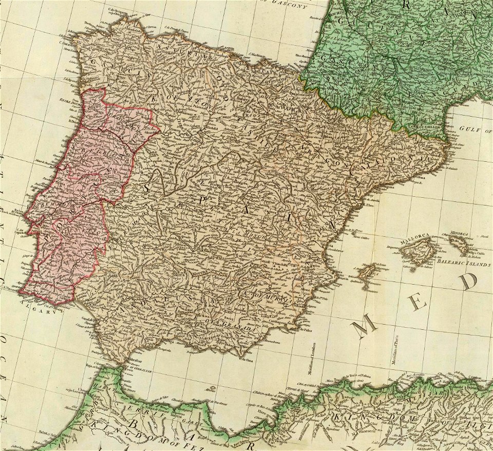
old maps of the iberian peninsula
1780s maps of spain
david rumsey historical map collection
jr
third voyage of willem barentsz
history of dutch sea fisheries
third voyage of willem barentsz
history of dutch sea fisheries
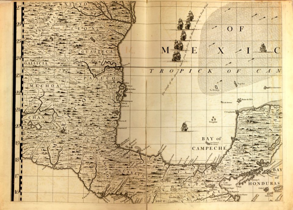
a map of the british empire in america with the french and spanish settlements adjacent thereto
maps in the library of congress
a map of the british empire in america with the french and spanish settlements adjacent thereto
maps in the library of congress
maps in the library of congress
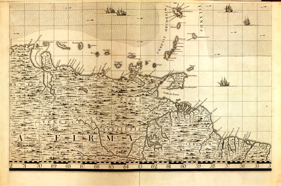
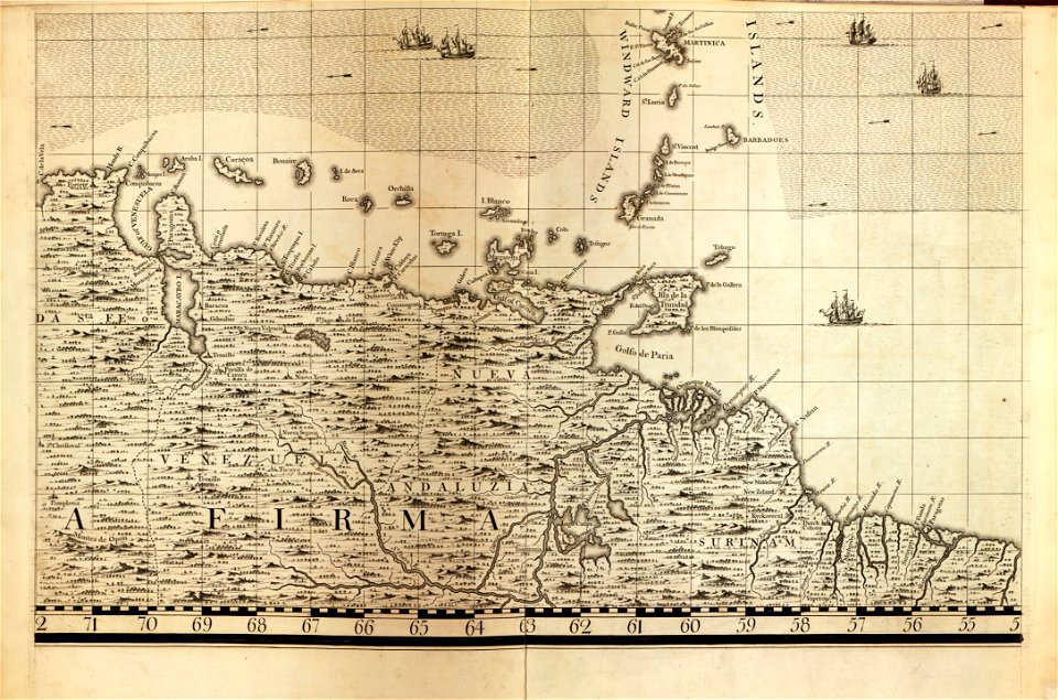
18th-century maps of barbados
maps in the library of congress
18th-century maps of barbados
maps in the library of congress
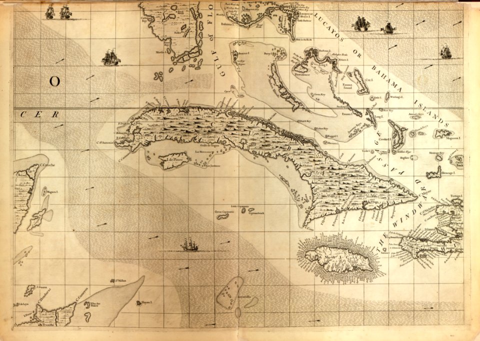
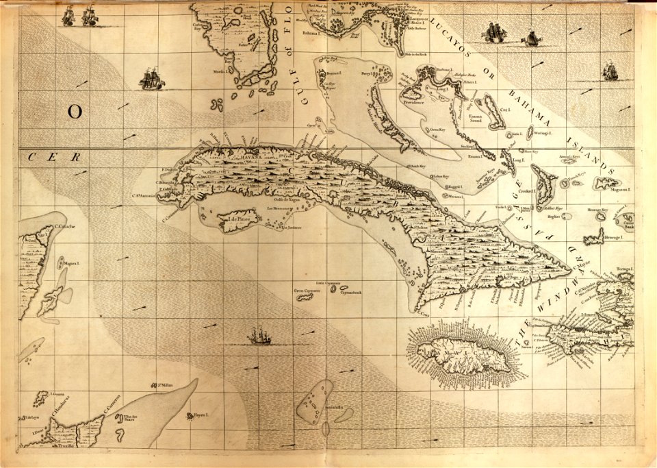
18th-century maps of cuba
maps in the library of congress
18th-century maps of cuba
the voyage of the vega round asia and europe
third voyage of willem barentsz
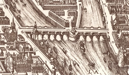
historical images of the place dauphine (paris)
historical images of pont neuf
david rumsey historical map collection
maps by frederick de wit
maps of paris from the david rumsey historical map collection
1863 maps
david rumsey historical map collection
j. and p. knapton
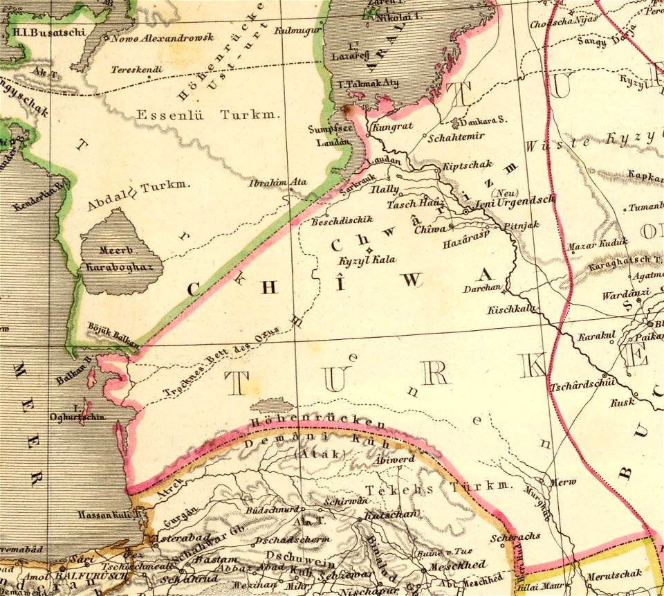
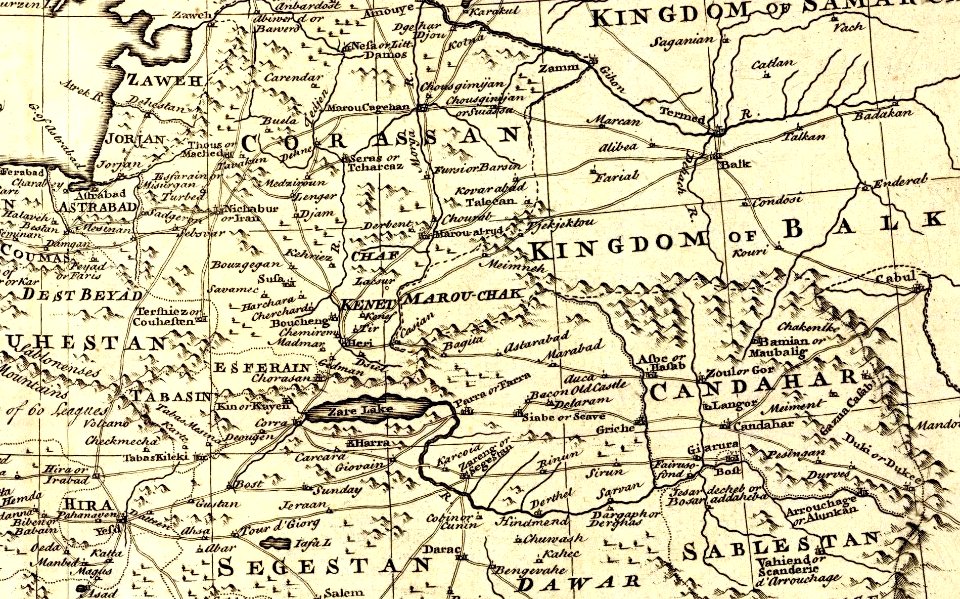
kandahar province
j. and p. knapton
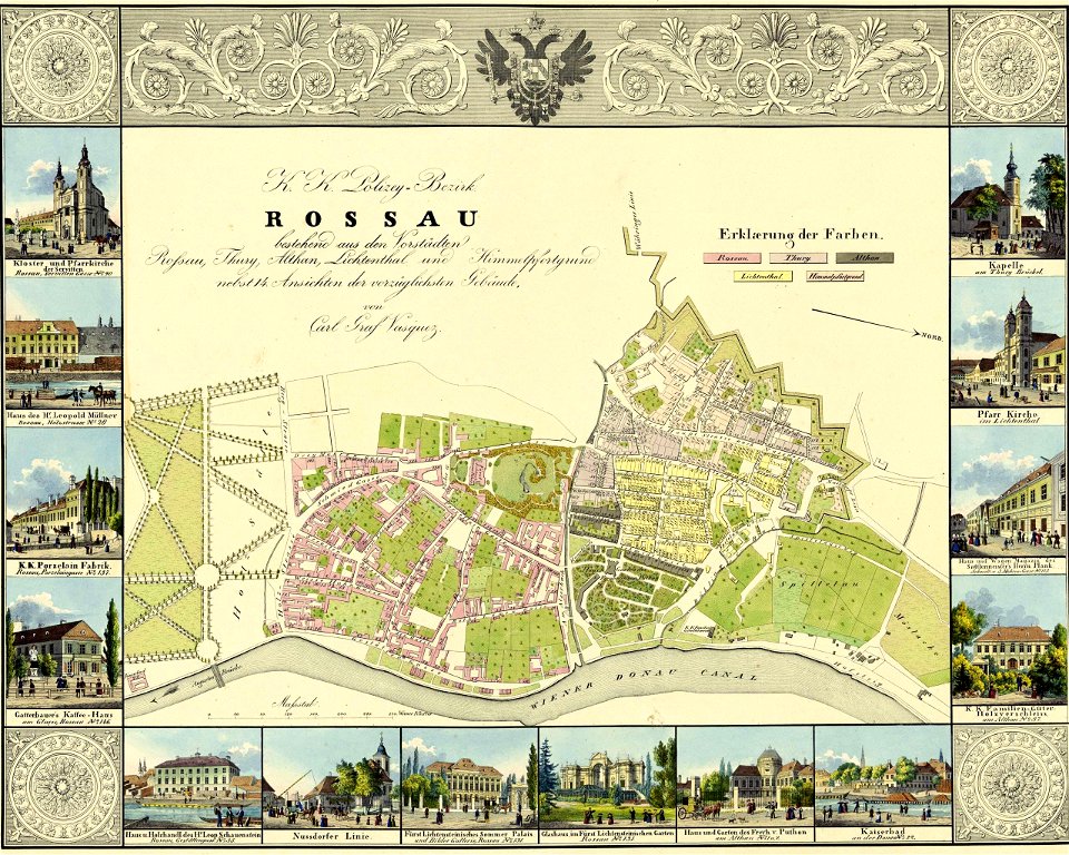
palais liechtenstein (fürstengasse)
vienna
a map of the british empire in america with the french and spanish settlements adjacent thereto
maps in the library of congress
a map of the british empire in america with the french and spanish settlements adjacent thereto
maps in the library of congress
a map of the british empire in america with the french and spanish settlements adjacent thereto
maps in the library of congress
a map of the british empire in america with the french and spanish settlements adjacent thereto
maps in the library of congress
david rumsey historical map collection
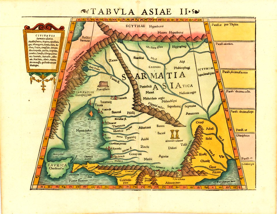
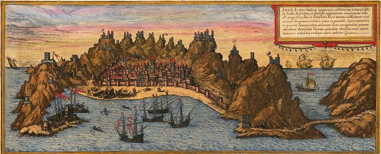
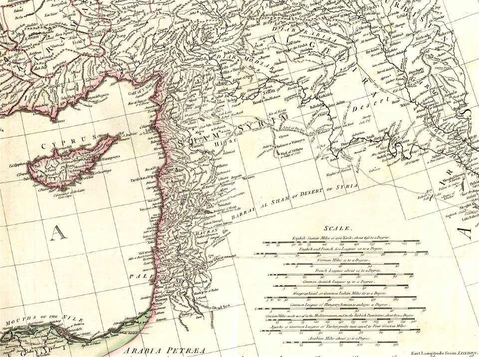
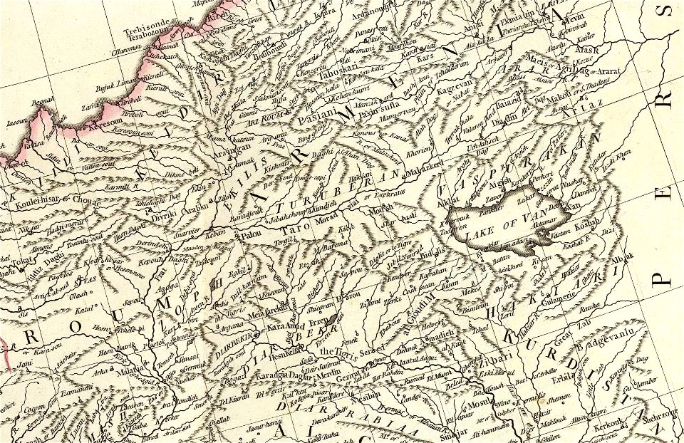
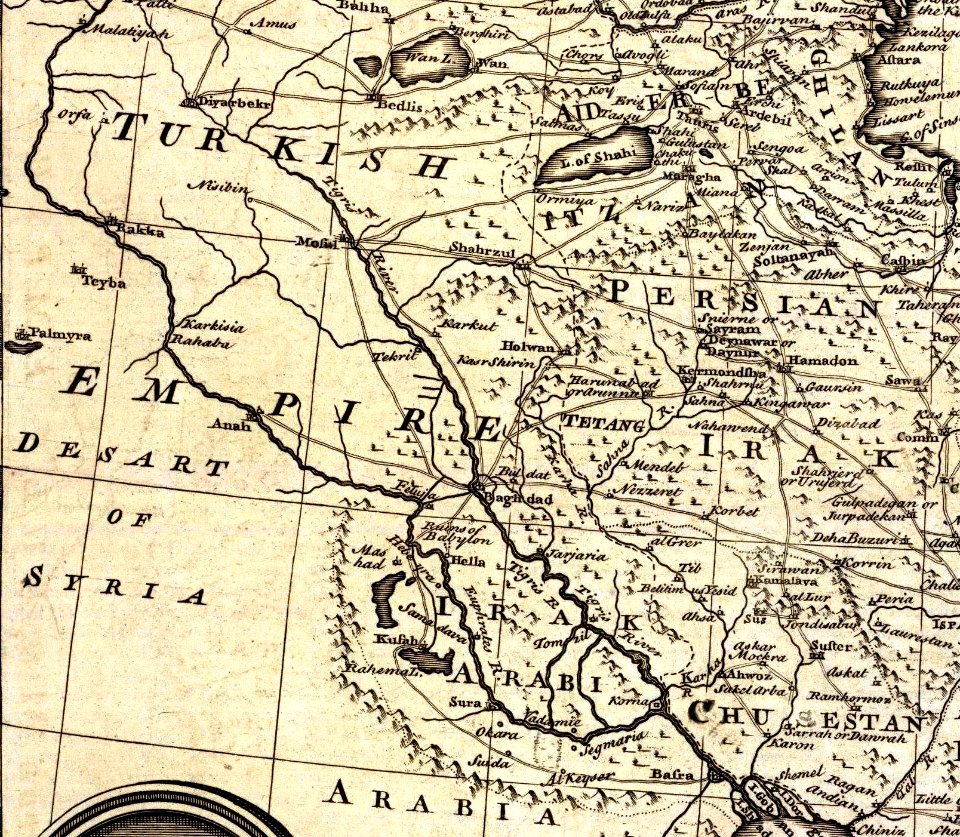
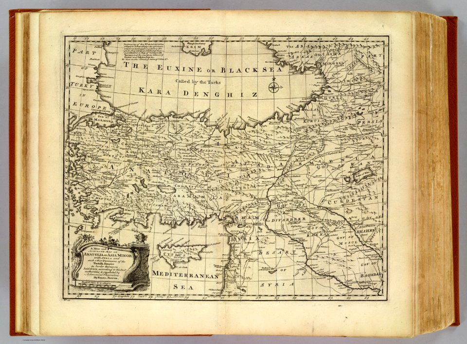
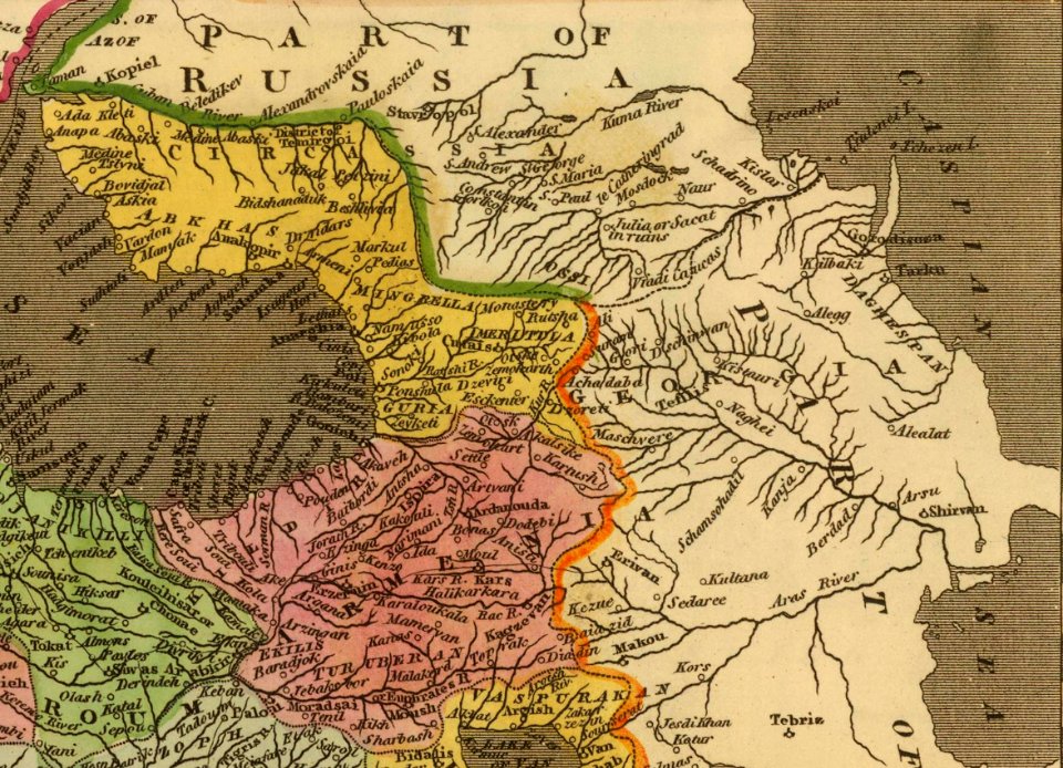
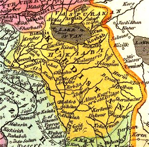
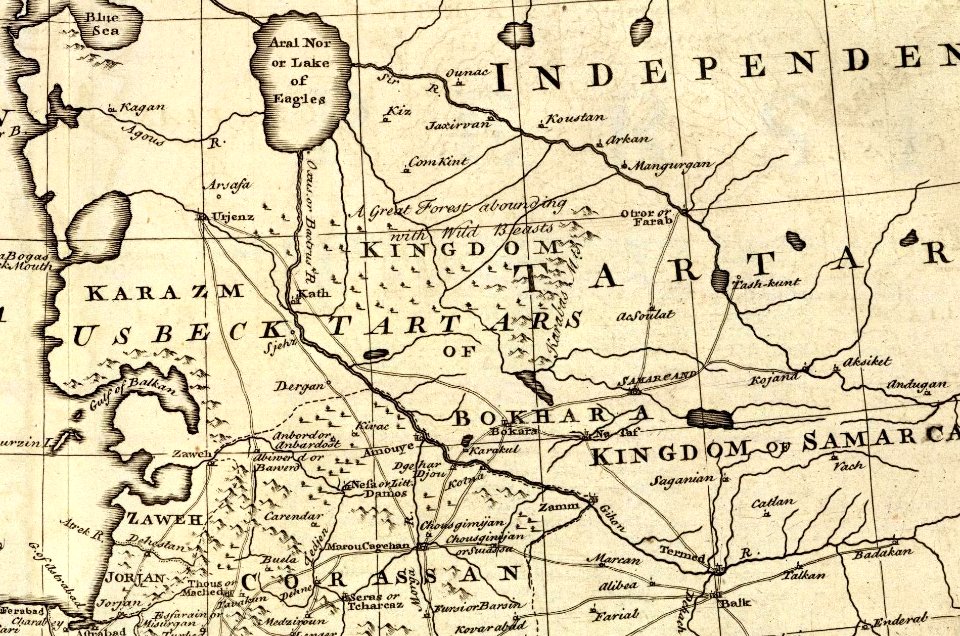
old maps of the middle east
david rumsey historical map collection
old maps of turkey
maps by willem and johannes blaeu
latin-language maps
david rumsey historical map collection
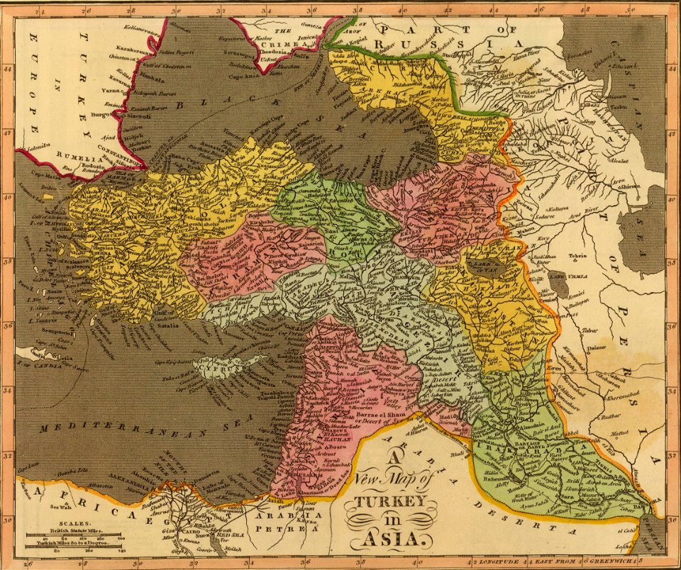
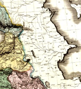
19th-century maps of the black sea
old maps of south africa
swartland
overwintering on nova zembla by willem barentsz, 1596-1597
maps in the rijksmuseum amsterdam
old maps of the middle east
jr
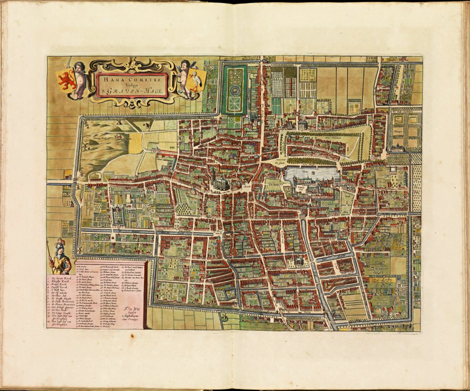
the hague stork in art
old maps of the hague
itinerario (jan huygen van linschoten)
latin-language maps
david rumsey historical map collection
j. and p. knapton
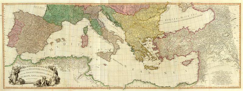
maps of the eastern mediterranean
jr
map images supported by wikimedia uk
1856 maps
david rumsey historical map collection
maps with cartouches
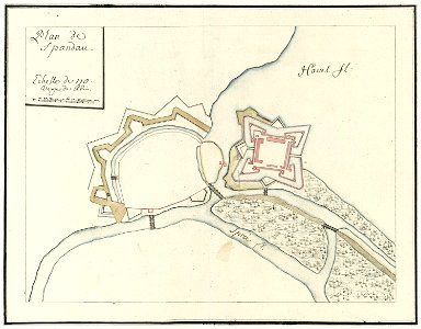
city walls of berlin-spandau
moll's map collection
cornell university library
cartography
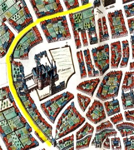
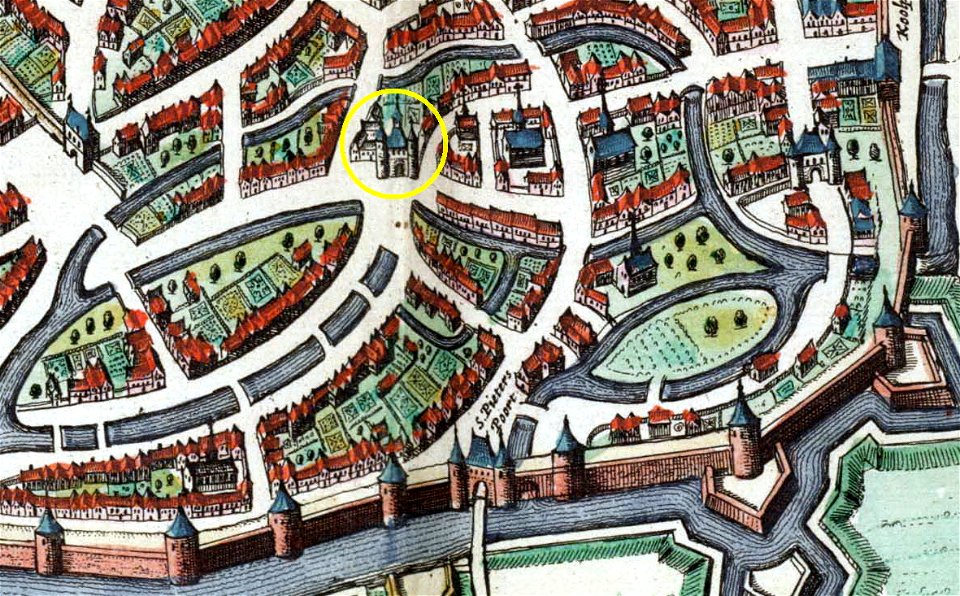
history of sint-servaasbrug (maastricht)
onze lieve vrouwewal (maastricht)
map of maastricht by willem and johannes blaeu (1649)
city gates in maastricht
david rumsey historical map collection
j. and p. knapton
old maps of the middle east
jr
maps of paris from the david rumsey historical map collection
1872 maps
map of paris by claes jansz. visscher - derivate files
historical images of abbaye de saint-germain-des-prés
david rumsey historical map collection
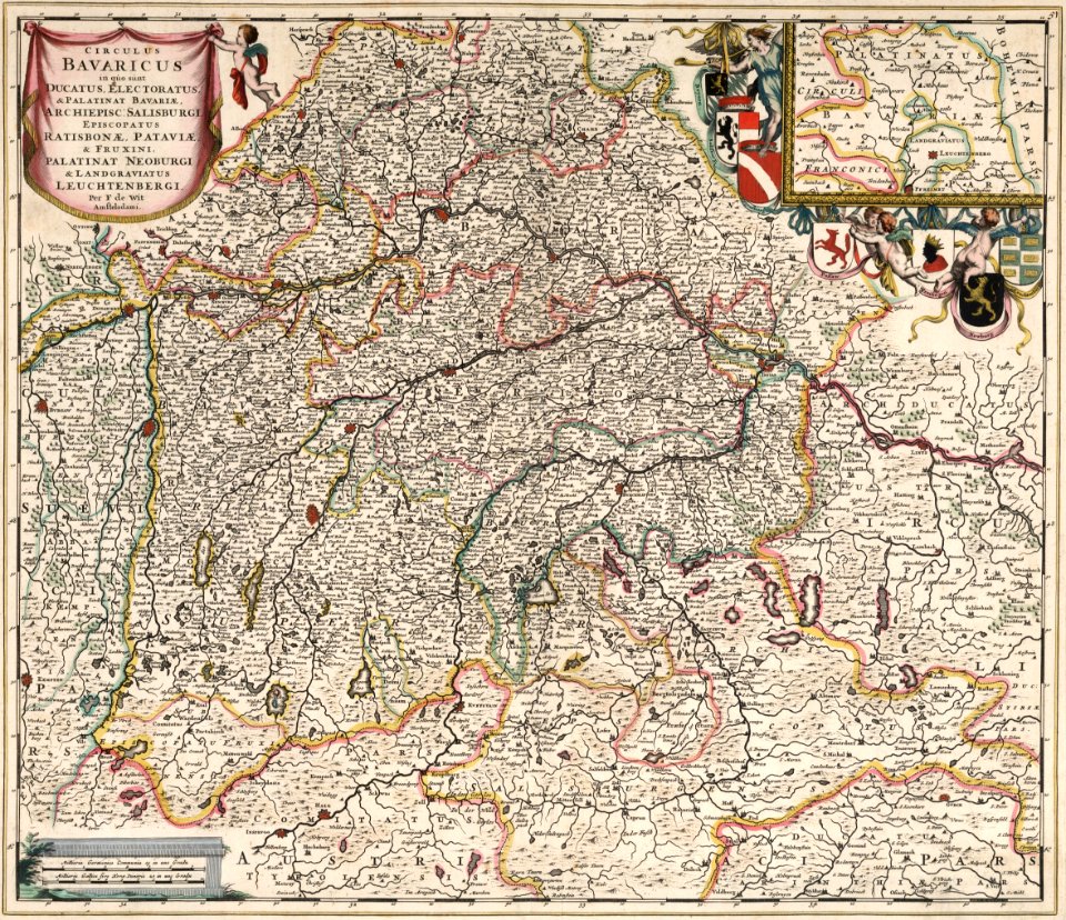
german-language maps
david rumsey historical map collection
german-language maps
david rumsey historical map collection
german-language maps
david rumsey historical map collection
jr
david rumsey historical map collection
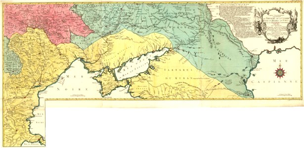
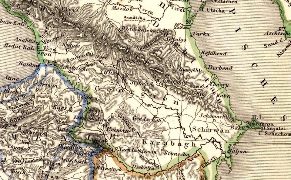
old maps of samegrelo
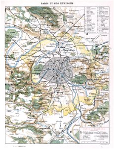
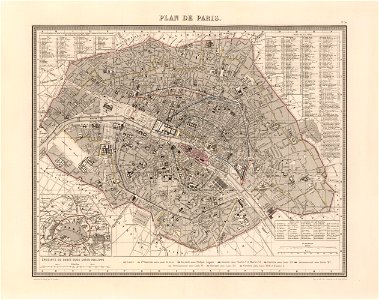
maps of paris from the david rumsey historical map collection
1869 in paris
maps of paris from the david rumsey historical map collection
1866 in paris
maps of paris from the david rumsey historical map collection
1856 maps
1874 in paris
1874 maps
1865 in paris
1865 maps
1886 in paris
1886 maps
latin-language maps
armenian
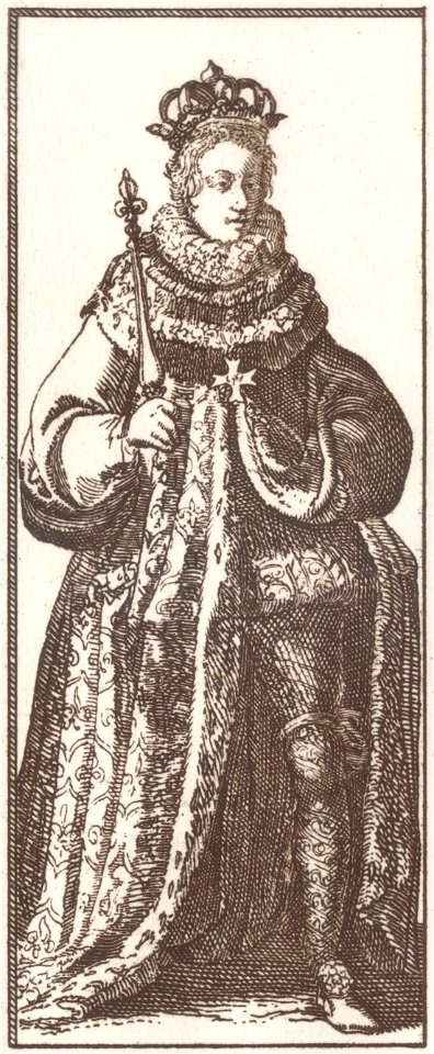
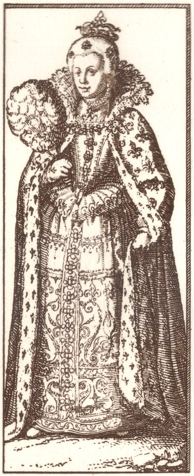
17th-century people of paris
history of fashion in paris
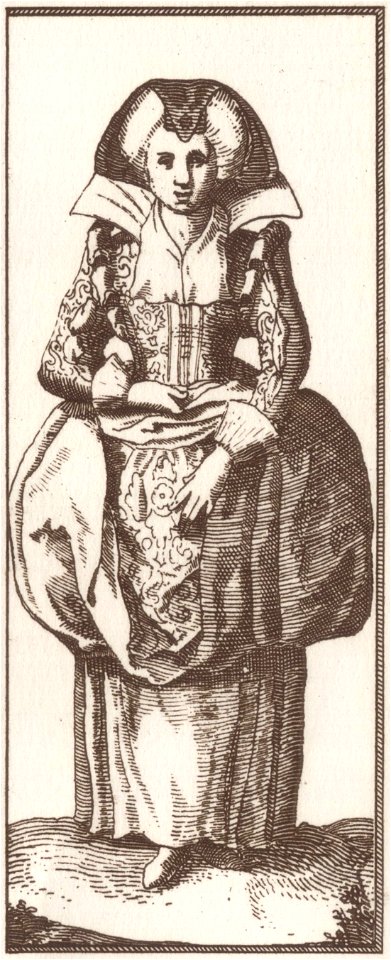
17th-century people of paris
history of fashion in paris
17th-century people of paris
history of fashion in paris
17th-century people of paris
history of fashion in paris
david rumsey historical map collection
german-language maps
david rumsey historical map collection
jr
david rumsey historical map collection
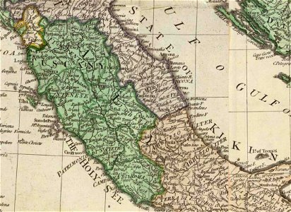
old maps of marche
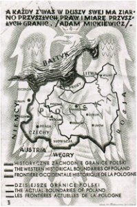
greater poland
map postcards
david rumsey historical map collection
j. and p. knapton
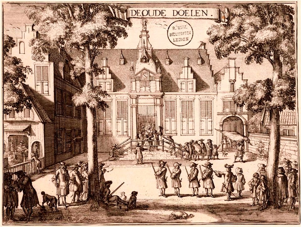
kloveniersschutterij (haarlem)
kloveniersdoelen (haarlem)
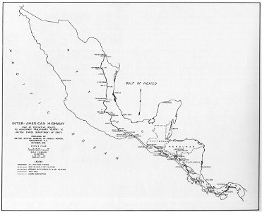
1933 in road transport
road map
david rumsey historical map collection
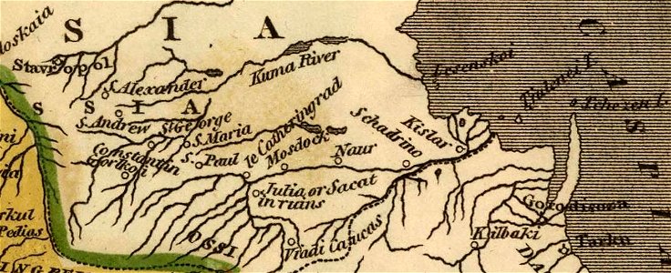
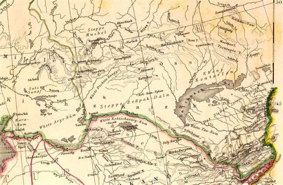
old maps of the russian empire
1900s maps of paris
1906 in paris
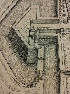
historical images of the cathedral (ferrara)
map of ferrara by andrea bolzoni
1101 - 1200 of 33,222
Next page
/ 333